Gifting Made Simple
Give the Gift of ChoiceClick below to purchase a Prairie Mall eGift Card that can be used at participating retailers at Prairie Mall.Buy Gift CardHome
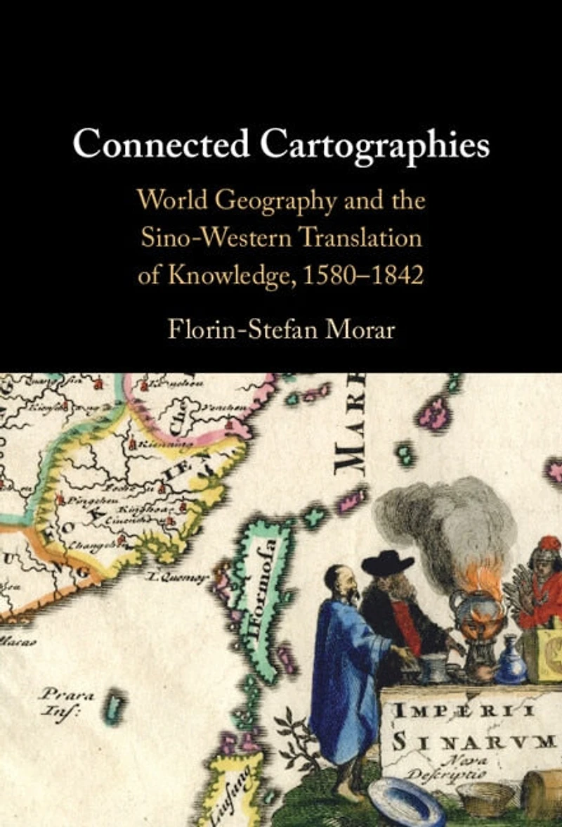
Connected Cartographies: World Geography and the Sino-Western Translation of Knowledge, 1580-1842
Coles
Loading Inventory...
Connected Cartographies: World Geography and the Sino-Western Translation of Knowledge, 1580-1842
By None
Current price: $137.95
Coles
Connected Cartographies: World Geography and the Sino-Western Translation of Knowledge, 1580-1842
By None
Current price: $137.95
Loading Inventory...
Size: Hardcover
*Product information and pricing may vary - to confirm current pricing, availability, shipping, and return information please contact Coles. In the event of a pricing discrepancy, the retailer's price will apply.
In the 'Age of Discovery', explorers brought a wealth of information about new and strange lands from across the oceans. Yet, even as the Americas appeared on new world maps, China remained a cartographic mystery. How was the puzzle of China's geography unravelled? Connected Cartographies demonstrates that knowledge about China was generated differently, not through exploration but through a fascinating bi-directional cross-cultural exchange of knowledge. Florin-Stefan Morar shows that interactions between Chinese and Western cartographic traditions led to the creation of a new genre of maps that incorporated features from both. This genre included works by renowned cartographers such as Abraham Ortelius and Matteo Ricci and other less-known works, 'black tulips of cartography,' hidden in special collections. Morar builds upon original sources in multiple languages from archives across three continents, producing a pioneering reconstruction of Sino-Western cartographic exchanges that shaped the modern world map and our shared global perspective.
In the 'Age of Discovery', explorers brought a wealth of information about new and strange lands from across the oceans. Yet, even as the Americas appeared on new world maps, China remained a cartographic mystery. How was the puzzle of China's geography unravelled? Connected Cartographies demonstrates that knowledge about China was generated differently, not through exploration but through a fascinating bi-directional cross-cultural exchange of knowledge. Florin-Stefan Morar shows that interactions between Chinese and Western cartographic traditions led to the creation of a new genre of maps that incorporated features from both. This genre included works by renowned cartographers such as Abraham Ortelius and Matteo Ricci and other less-known works, 'black tulips of cartography,' hidden in special collections. Morar builds upon original sources in multiple languages from archives across three continents, producing a pioneering reconstruction of Sino-Western cartographic exchanges that shaped the modern world map and our shared global perspective.