


Gifting Made Simple
Give the Gift of ChoiceClick below to purchase a Prairie Mall eGift Card that can be used at participating retailers at Prairie Mall.Buy Gift CardHome
A Country So Interesting: The Hudson's Bay Company and Two Centuries of Mapping, 1670-1870
Coles
Loading Inventory...
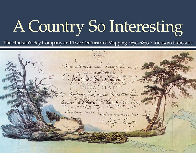
A Country So Interesting: The Hudson's Bay Company and Two Centuries of Mapping, 1670-1870 in Grande Prairie, AB
Current price: $61.24
Coles
A Country So Interesting: The Hudson's Bay Company and Two Centuries of Mapping, 1670-1870 in Grande Prairie, AB
Current price: $61.24
Loading Inventory...
Size: Paperback
*Product information and pricing may vary - to confirm current pricing, availability, shipping, and return information please contact Coles. In the event of a pricing discrepancy, the retailer's price will apply.
Maps were an essential tool for the Hudson's Bay Company and during the two centuries before Confederation the Company became the main mapping agency in British North America for the immense territory extending from Ungava Bay to the Pacific Ocean.
In A Country So Interesting Richard Ruggles describes and analyses the mapping activities of more than 160 Company servants and surveyors as well as the contributions of more than 50 Indians and Inuit who drew sketches and provided original configurations. Also included are annotated catalogues of all the maps known to have been produced by the Hudson's Bay Company and sixty-six reproductions of the most important maps and sketches.
The Hudson's Bay Company was responsible for the largest collection in North America of manuscript charts and maps related to the fur trade and Ruggles has produced the first and most comprehensive study of this unique and rich body of material.
Maps were an essential tool for the Hudson's Bay Company and during the two centuries before Confederation the Company became the main mapping agency in British North America for the immense territory extending from Ungava Bay to the Pacific Ocean.
In A Country So Interesting Richard Ruggles describes and analyses the mapping activities of more than 160 Company servants and surveyors as well as the contributions of more than 50 Indians and Inuit who drew sketches and provided original configurations. Also included are annotated catalogues of all the maps known to have been produced by the Hudson's Bay Company and sixty-six reproductions of the most important maps and sketches.
The Hudson's Bay Company was responsible for the largest collection in North America of manuscript charts and maps related to the fur trade and Ruggles has produced the first and most comprehensive study of this unique and rich body of material.
You May Also Like
![A Journey From Prince of Wales's Fort, in Hudson's Bay, to the Northern Ocean [microform]: Undertaken by Order of the Hudson's Bay Company for the Discovery of Copper Mines, a North West Passage, &c. in the Years 1769, 1770, 1771 & 1772](https://cdn.mall.adeptmind.ai/https%253A%252F%252Fcdn.shopify.com%252Fs%252Ffiles%252F1%252F0655%252F8980%252F5233%252Ffiles%252F1_54a86090-f63c-4694-9ce9-f3f084e1089b.jpg_medium.webp)








Find at Prairie Mall in Grande Prairie, AB
Visit at Prairie Mall in Grande Prairie, AB